Leppner Alm

Carinthia, Austria
Leppner Alm
Photo © Martin Weber
Offroad Österreich Leppner Alm
For this track there are currently official closures or restrictions. Please check the comments for details.
Length
16km
Max. Height
1650m
Difficulty
Light
Suitable for
motorcyclesuvcamper
Rating

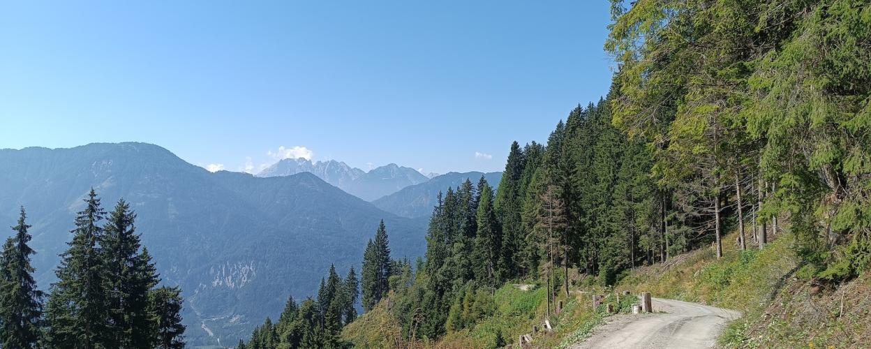
An easy 16 km tour leads into the mountains to the Leppner Alm. Relax in the alpine nature at a small mountain lake with magnificent panoramic views.

From Irschen on the B 100, the route climbs up a tarred road, passing a few holiday homes at the end of the village. Groups of trees stand on the hillside. As you ride uphill on winding roads, you can enjoy fantastic views of the Drau Valley. More wooden huts line the route, which turns into a well-maintained, flat and easily navigable gravel track. There is a picnic area with wooden benches right next to the path. The next section takes you through a wooded area, around a few sharp hairpin bends and then to green alpine meadows with the wonderful Bergheimat alpine inn. Various huts and hiking trails can be found on the wide plateau. We recommend a short hike to the Leppner Knappensee lake. Here you can enjoy fantastic views and relax with a break by the small lake with its beautiful stream in this wonderful area.


Elevation
Community-Reports (4 Reports)
S
Sarah
09. Juli 2026
Date of visit:
07.07.2026
Vehicle used:
Tenere 700 & 1200 GS
Closure or obstruction:
Yes

Hi everyone, because of the sign—see the picture (the gate was open)—we didn't drive any further. By the way, in your video you also drive past this sign 🤪☺️. Maybe you could clarify this again? Best regards

O
Offroad Atlas Team
24. Februar 2026
Date of visit:
Sept 24
Vehicle used:
BMW F800GS
Closure or obstruction:
No

The route was not closed during our last ride; see also the video. If it has since been closed, please let us know after your ride :))

W
Walter
09. Dezember 2025
Date of visit:
wäre geplant
Vehicle used:
Reiseenduro
Closure or obstruction:
Yes

I'd actually like to know if the trail is legally accessible. At coordinates 46.76287752982868, 13.025567859230806, at the transition from asphalt to gravel, the road is marked with a "No Entry" sign for the "Fortstrasse." These are normally not legally drivable in Austria. Attached is an image from Google Maps (I’ll confirm that it “belongs” to me ;-) ) – @ Mods – if this is not allowed, please remove it, but also mark the track as not legally drivable if necessary

H
Helmut
23. Februar 2026
Closure or obstruction:
No

That's clear enough. Thanks. Then we should remove this track as well.