Passo delle Forcella
Friuli Venezia Giulia · Italy

Lago di Sauris

22 km·up to 1.820 m·Medium·
Length
22 km
Max. Height
1.820 m
Difficulty
Medium
Rating
★ 4.3
6 reports

From Ampezzo, located on the SS 52, you can reach Lago di Sauris via the SP 73. This is where the beautiful 22 km tour through the varied nature of the Friulian mountains starts. 

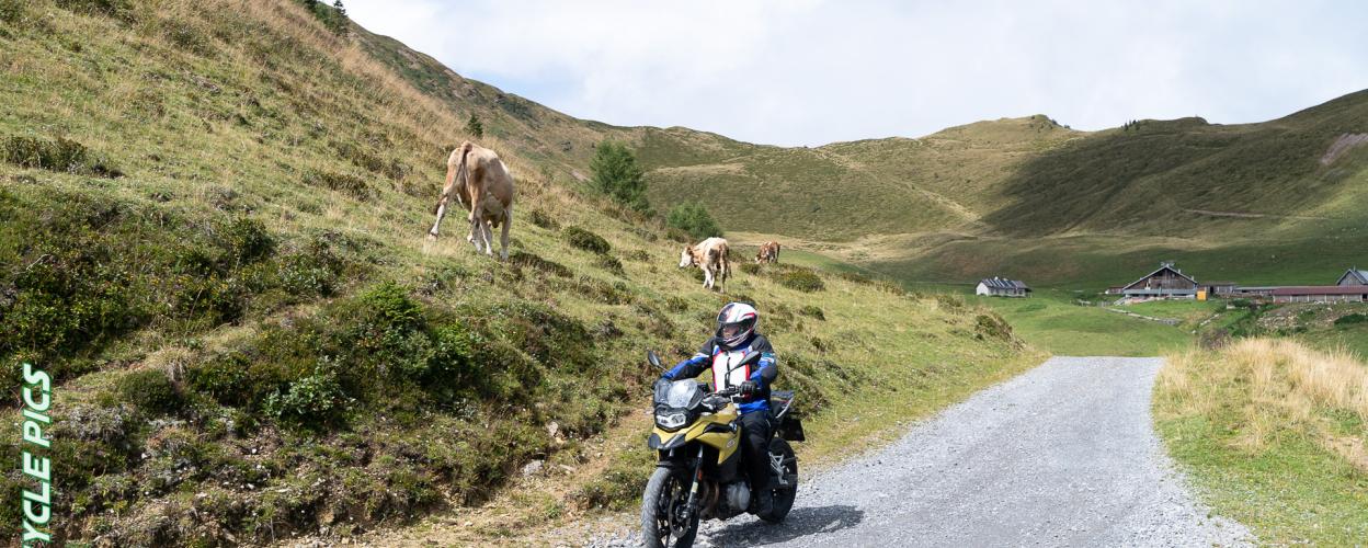
From the village of Lateis, it first goes steeply uphill on a narrow, single-lane tarmac road. Continue along the route, then follow a forest path slightly downhill. You cross the river Pieltinis, with its beautiful flat riverbed and rock steps. Along the mountainside, the track winds across meadows, past some groups of trees and impresses with fantastic views. The Rifugio Casera Losa, surrounded by cow pastures, invites you to take a break right along the route. The route continues on an easy-to-drive gravel road, which alternates again and again with concrete sections and leads over the ridge down to the Passo della Forcella. Surrounded by magnificent, lush mountain meadows, you can enjoy panoramic views as far as the Dolomites from the spectacular vantage point at the pass. In the last section to the village of Ovaro there is a crisp, very steep descent, which leads over a small tarmac road to the end of the tour on the SP 355. In the extensive valley on the river Degano there are family restaurants and cafes with original Italian cuisine.

Elevation
From the community

Latest reports

Conditions, closures and tips — from members who drove here recently.

The route offers sensational views of many surrounding valleys and mountains. From the village of Lateis, the route follows a narrow, winding paved road with gradients of up to 25%, as described. If you like cheese, you can then buy it directly from the producer at a local alpine farm. It’s a route I’d even ride twice!

C
Christian Berling
Geländewagen · 08.07.2026
Closure or obstruction

I drove from Ovaro to Lateis... I noticed the no-entry sign in Ovaro, but you could also interpret it as applying to the small dirt road right next to it 😉 The route was beautiful; I didn't see a soul. I didn’t see a no-entry sign on the way from Lateis to Ovaro either.

L
Lorenz
Husqvarna 701 Enduro · 02.06.2026

I couldn't agree more—no roadblocks or signs on Lateis. The best way to tackle the downhill tar road is with a low gear ratio.

D
DQ
Jeep Cherokee XJ · 15.09.25

Everything tip top. No prohibition signs from Latais. Attention descent to Ovaro very steep. Only possible with a gear reduction.

A
AndytheLandy
Landrover Defender · 18.7.2025
Closure or obstruction

Overall, a very scenic route. However, it is closed from the Ovaris side (traffic sign No. 250—no vehicles of any kind allowed) at the edge of the small village. From Lateis, passage was permitted with restrictions: allowed from Friday 5:00 p.m. to Monday 7:00 a.m.—written on a note attached to a small wooden sign.

H
Holly
RAM 1500 4x4 · 03.05.2025

Just as described in the text. The climb from Ovaro is really very steep, but paved. In general, the very steep sections are paved. The panoramic road at the top is easy to drive on, though there is a lot of loose gravel and it hasn’t been compacted much. The view is amazing and very idyllic, and there wasn’t a soul else on the road :) At a fork in the road, you could continue following the TET Italy route.

M
Moritz
Tenere 700 · 11.07.2024
Keep going

Tracks Nearby