 German
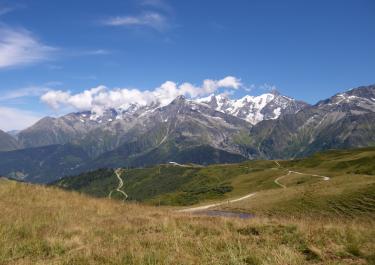
Easy-to-ride trails, passing by a nice alpine hut where it's worth stopping for a break. Great panoramic views with some animal traffic coming the other way 😉
A
Adventure-Pussy
Mercedes Sprinter 6m · July 2026


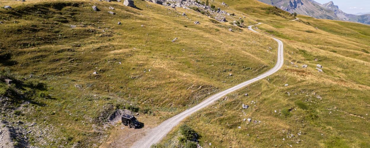
Between Chamonix in the east and Annecy in the west lies one of the most stunning off-road panoramic routes in the French Alps. The trail winds its way along the mountainside, maintaining a relatively consistent elevation, and offers breathtaking views of the Mont Blanc massif to the east. Along the way, you’ll pass several working alpine farms, many of which sell cheese. Be sure to stop, take a break, and pick up some Reblochon cheese.
The route begins in Ugine, a village situated on the D1508. A narrow paved road climbs up the mountainside in countless switchbacks, with the glaciers of Mont Charvin coming into view on the left. At an altitude of 1,580 meters, you’ll reach the Col de l’Arpetazz and its namesake mountain hut. Here, the gravel track begins.
Wide and well-maintained, the gravel road serves as a true panoramic route, following the mountain ridge. The scenery is a mix of meadows, pastures, and patches of forest, always accompanied by views of the Mont Blanc’s eternal ice. Passing the high alpine pasture of Boegneuve (1,710 meters), the route reaches a fork. Keep to the right and enjoy the scenic, easily navigable road as it descends gently toward the Col des Aravis. The gravel road ends at the D909 atop the pass.
Conditions, closures and tips — from members who drove here recently.
Easy-to-ride trails, passing by a nice alpine hut where it's worth stopping for a break. Great panoramic views with some animal traffic coming the other way 😉
A wonderful off-road tour with a permanent view of the Mont Blanc massif! The ascent along a narrow but well-maintained road with countless hairpin bends is great fun. Once you reach the top, you should definitely enjoy the delicious food at the hut before continuing on the gravel road. It is easy to drive on, but in some places you will be glad to have enough ground clearance. Otherwise, there are no special requirements for equipment or riders. About 2.5 km before the end of the tour (Col des Aravis), we spent the night on the left-hand side in a small bay with a wonderful view of Mont Blanc. All in all, a highly recommended off-road tour!
A beautiful route along the Aravis Range. The route is easy to ride. There are a few places to stay overnight along the way. On weekends and in the height of summer, there are many hikers, cyclists, and others, especially on the first section starting from Col des Aravis. So it’s best to ride during off-peak hours.
Very nice!
I'll be riding tomorrow—I'm feeling optimistic. The plan is to spend the night halfway up to the Col de l'Arpettaz. It’s very quiet; every now and then a car or a road bike passes by. Otherwise, all you hear is chirping and cowbells. Low clouds are limiting the view...:
The climb from Ugine to Col de l’Arpettaz (11.8 km) 3 and as another Aravis high-altitude road, the Route des Montagnes in SG 4 https://alpenrouten.de/Arpettaz-Col-de-l-Route-des-Montagnes_point30.ht… - Transalper The Col de l’Arpettaz is located north of the town of Ugine at the southwestern end of the Aravis range. Fans of winding mountain roads will get their money’s worth on the SW ramp: with 37 hairpin turns, the still-paved route between Ugine and the summit gains elevation. At the pass summit, there is the option to descend toward the SE to Hauteville or Héry. More interesting, however, is the gravel continuation toward the northeast via the scenic Aravis high-altitude road (Route des Montagnes). It runs along the southeastern flank of the Aravis range and stretches between the Col de l’Arpettaz and the summit of the Col des Aravis. In winter, or as long as the road is still blocked by remaining snow, no-entry signs may be posted at the access points, though the reason for the closure is stated only in French on an attached A4 sheet.
 France