German

Track to Queixans
Northeast of Ribes de Freser, the well-developed national road N 260 leads over to the valley of the river el Segre. This route is comfortable and saves time. But who wants to save time? Off-road fans definitely don't. They want fun. And they get that on an alternative route to the N 260.
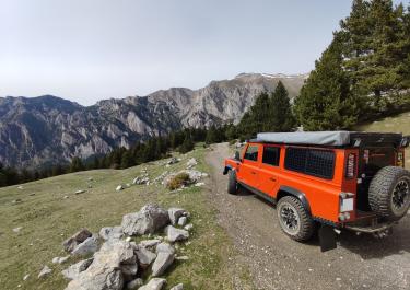
About 21 kilometers west of Ribes de Freser, the N 260, with its fantastic curves, crosses the unspectacular Collada de Toses at an altitude of 1,791 meters, although it has been restored to a pretty good standard. After that, it's about seven kilometers until a forest road branches off to the right. First, it leads through dense deciduous and coniferous forests, until it eventually leaves the trees behind and offers one or two mountain panoramas. The road is lightly graveled, fairly wide and has no surprises. Wide curves alternate with serpentines and never let you get bored. Finally, the track descends towards the valley and becomes a small asphalt road just before the village of Queixans, which has a population of 180. To the right, take the N 260 to Puigcerdà and to the left to el Vilar d’Urtx.
Latest reports
Conditions, closures and tips — from members who drove here recently.

 Spain