German
Lost Place on Monte Limbara
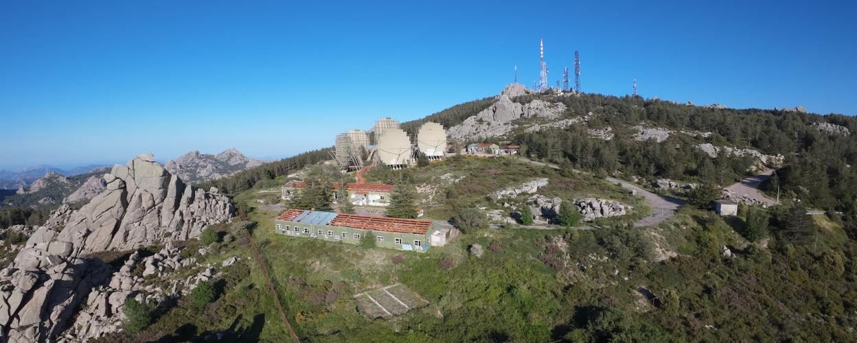
At 1,363 meters, Monte Limbara is the highest mountain massif in northern Sardinia. Its highest peaks are Punta Balistreri (1,363 m) and Punta sa Berritta (1,359 m). Situated on the plateau just below these two peaks is the former NATO radio station "4 Carlie." It was part of the MEDCOM radio network, which covered the Mediterranean region. Later, stations were added in Northern and Central Europe, including one on the Feldberg in the Black Forest. The US Air Force operated the Monte Limbara facility from 1966 to 1999; today, satellites handle these tasks.
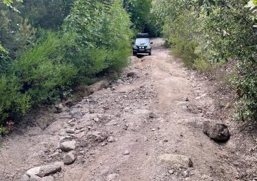
Although a mountain road leads to 4 Carlie, the gravel route starting from Berchidda is far more interesting. The town is located on the SS 729, west of Olbia. From an elevation of approximately 250 meters, the gravel track climbs relatively steadily for 16 kilometers, reaching the radio plateau at an altitude of 1,338 meters. While the first two-thirds of the route are relatively easy, the upper section is quite challenging: deep, washed-out ruts filled with large stones and slabs of rock dot the path, which becomes increasingly steep. If there is only a single rut, a motorcyclist can steer to the other side of the track to avoid it; however, if there are two parallel ruts, there is no choice but to grit one's teeth and push through. For off-road vehicles, four-wheel drive and high ground clearance are essential. The descent follows the paved road toward Tempio Pausania.
Latest reports
Conditions, closures and tips — from members who drove here recently.
 Italy