German
Closure or obstruction
The road from Bousson to Lago di Nero is passable, but there is a no-entry sign at the turnoff toward Valle di Thuras (44.9107493, 6.8003302).
S
Stefanie
BMW F800GS · 5.9.25



From Sestiere on the SP 23R, head south on the SP 215 towards Bousson. The 12 km tour through the valleys and mountains of the border region with France, in the beautiful Valle di Thuras, starts here in the village of Thures.
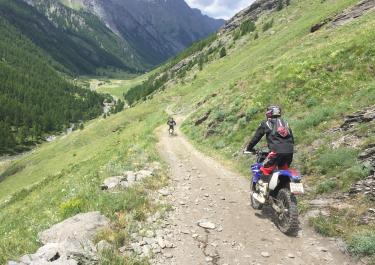
The gravel road begins behind the village of Thures. The route leads through beautiful countryside parallel to the Torrente Thuras river, initially through the valley to the idyllic alpine village of Rhuilles. Here you cross the river with a view of the imposing mountains. After Chaboud, where there are ruins, the route now climbs up a few hairpin bends, sometimes steeply over rough gravel. The track is also peppered with rain holes. After a section of forest, a dirt track follows and the route now descends over slight bumps. After a small wooden bridge, the last section of the path is wide and easy to ride on. This tour ends at a small tarred road in the village of Bousson. The area around the Valle di Thuras is a beautiful Alpine valley and is ideal for walks and trekking tours of varying degrees of difficulty after a motorcycle tour.
Conditions, closures and tips — from members who drove here recently.
The road from Bousson to Lago di Nero is passable, but there is a no-entry sign at the turnoff toward Valle di Thuras (44.9107493, 6.8003302).
The route is closed from the small village of Rhuilles onwards.
 Italy