German
Everything's perfect, thank you
V
Vitalii
Geländewagen · 08.09.26


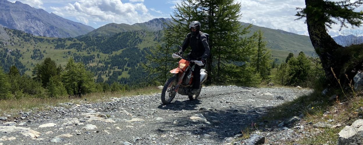
The 24 km tour leads from Bousson on the SP 215 uphill and downhill to the French-Italian border past beautiful mountain lakes.
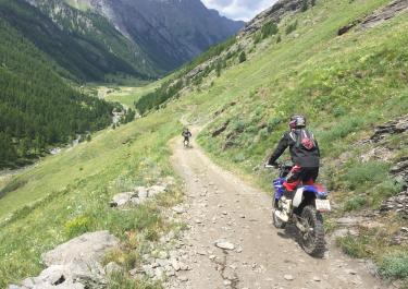
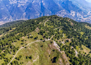
The starting point of the route is the village of Bousson. The gravel road begins at the end of the houses and leads through wide hairpin bends up towards Lago Nero. At the small Madonna del Lago chapel and around Lake Nero, there are many beautiful meadows where you can enjoy a picnic. The view is wonderful. In the next section of the route, which is a little rougher and littered with stones, the path is partly crossed by small streams. A stitch with a wonderful view leads to the French border. After a few meters on foot, you reach the glistening Lac Gignoux in a valley basin. From the cul-de-sac, the route leads back downhill more steeply over stony sections after Colle Bercia. The Gimont inn on the small Lago Freddo, surrounded by forest, is a fantastic place for a break. The last section leads past another inn and then continues through the forest on a steep descent to the end point on the SS 24.
Conditions, closures and tips — from members who drove here recently.
Everything's perfect, thank you
Conversation with Gemini I’d like to write a comment or review about an off-road track from foly maps westalpen. See the attached photo for the map publisher’s description. Can you help me with this? The goal is always to keep it as short as possible, in both German and English, so that as many people as possible can benefit. Sure, I’d be happy to help you with that! The photo shows the exact call to action from offroadatlas.de (Foly Maps) to submit experiences, status updates, and photos directly for the respective tour ID. To ensure the comment is as concise and informative as possible—and immediately useful to the community in both German and English—I’ve prepared a few compact templates for you. All you have to do is fill in the relevant key details. Template 1: Focus on current condition & drivability (Classic) German: Status [Month/Year]: Very nice route. The surface is currently [good / rough / washed out]. Easily rideable/drivable with [Enduro / 4x4 / Adventure Bike]. [Optional: Road closure / Gate / Snow at XX m]. English: Status [Month/Year]: Great trail! Track condition is currently [good / rough / washed out]. Easily ridable/drivable with [Enduro / 4x4 / Adventure Bike]. [Optional: Closure / Barrier / Snow at XX m]. Template 2: Very short (facts in a nutshell) German: Current Update ([Date]): Condition: [dry / muddy / lots of loose rocks] Difficulty: [easy / medium / challenging] Vehicle: [e.g., Light Enduro / 4x4] Note: [e.g., Barrier open at the top / Observe time restrictions] English: Current Update ([Date]): Condition: [dry / muddy / loose rocks] Difficulty: [easy / moderate / challenging] Vehicle: [e.g., Light Enduro / 4x4] Note: [e.g., Barrier open / Mind time restrictions] Template 3: In case of closure / obstacle German: Notice ([Month/Year]): Trail currently not fully passable [at an elevation of XX m / after severe weather]. [Landslide / Barrier closed]. English: Notice ([Month/Year]): Trail currently blocked [at XX m altitude / after severe weather]. [Landslide / Barrier closed]. Tips for uploading to offroadatlas.de: Use the Tour ID: Enter the specific TOUR ID of the map directly on the website so that your comment is assigned to the exact right trail. Include photos: A quick photo of the current trail conditions or any obstacles is usually more helpful to the community than a long text description. If you provide me with specific details about your trip (which track, conditions, obstacles, vehicle), I’ll write up the final text for you directly in German and English! The three of us went for a motorcycle ride today. There’s a barrier at the start of the route. You get a ticket when you press the button, and the barrier opens. When you come back, you have to validate the ticket at a pay station for 5 €. The route is in very good condition with a perfect, fine-gravel surface. It’s very easy to ride up to the small bridge with the water crossing. From there on, it gets more winding and, above all, steeper and rockier—a bit more challenging on the way up to the alp. You can buy cheese at the top; it’s very affordable and tastes great. We were traveling by motorcycle. Here’s a concise, structured description in German and English that you can copy directly and paste onto offroadatlas.de (or via the QR code): German Update [July 2026] – A very beautiful route! Toll / Barrier: Barrier with a ticket at the start. Return trip: Validate at the ticket machine (€5.00). Condition: Very good, fine gravel surface. Difficulty: Very easy up to the small bridge (water crossing). After that, steeper, more winding, and rockier all the way to the alp—somewhat more challenging. Vehicles: Riden on a motorcycle (3 people). Tip: There’s very tasty and affordable cheese at the alp! English Update [July 2026] – Great trail! Toll / Barrier: Barrier at the start (take ticket). Pay €5.00 at the machine when returning. Condition: Excellent, fine gravel surface. Difficulty: Very easy up to the small bridge (water crossing). After that, the trail becomes steeper, more winding, and rockier all the way up to the alp—slightly more challenging. Vehicles: Traveled by motorcycle (3 riders). Tip: The local cheese at the top of the alp is delicious and cheap! Please omit the vehicle type and date from the text; I have to enter those manually in a separate field. Here are the revised texts without the date and without mentioning the vehicle type: German Beautiful route! Toll / Barrier: Barrier with ticket at the start. On the return trip, validate at the ticket machine (€5). Condition: Very good, fine gravel surface. Difficulty: Very easy up to the small bridge (water crossing). After that, steeper, more winding, and rockier all the way to the alp—somewhat more challenging. Tip: There’s delicious and affordable cheese at the alp! English Great trail! Toll / Barrier: Barrier at the start (take a ticket). Pay €5.00 at the machine upon return. Condition: Excellent, fine gravel surface. Difficulty: Very easy up to the small bridge (water crossing). After that, steeper, winding, and rockier up to the Alp—slightly more challenging. Tip: The local cheese at the top of the alp is delicious and cheap! Next trail. The route is varied and ranges widely in difficulty. We started from the eastern end. Relatively easy at the beginning. After about a third of the way, it gets much harder. It’s relatively steep with loose gravel and tight switchbacks. Inexperienced riders might struggle here. Once you reach the top, there are still a few more challenging descents with large rocks and slippery gravel all the way to the Refugio. Once you’ve left that behind, it gets easier and a bit flatter. We That’s where the text ended—did you want to add anything else there (e.g., where you ended up or how the route concluded)? If this is sufficient as is, here are the two super-concise versions without dates or vehicle types: German Varied route (starting from the east) Route: Start in the east is relatively easy. Middle section: After about 1/3 of the way, significantly more difficult—steep with loose gravel and tight switchbacks (dangerous for inexperienced drivers). Continuation: At the top, several challenging descents with large rocks and slippery gravel leading to the Refugio. Final section: After the refugio, the trail flattens out and becomes easier again. English Varied trail (Starting from the east) Section 1: The start from the east is relatively easy. Middle section: After about one-third of the way, the trail becomes much harder—steep with loose gravel and tight switchbacks (challenging for beginners). Further on: At the top, several tricky descents with loose gravel and large rocks lead down to the refugio. Final section: After the refugio, the trail flattens out and becomes easier again. Please note that the red difficulty rating is correct and that this route is more challenging than the Valle Argentera route. Here is the updated and revised version: English Varied route (starting from the east) Difficulty: The “red” rating is definitely accurate. Overall, the route is more challenging than the Valle Argentera route! Route description: The start in the east is relatively easy. Middle section: After about 1/3 of the way, it becomes significantly harder—steep with loose gravel and tight switchbacks (dangerous for inexperienced riders). Continuation: At the top, there are some challenging descents with large rocks and slippery gravel leading to the Refugio. Final section: After the refugio, the trail flattens out and becomes easier again. English Varied trail (Starting from the east) Difficulty: The red rating is definitely accurate. The trail is more challenging than Valle Argentera! Section 1: The start from the east is relatively easy. Middle section: After about one-third of the way, it gets much harder—steep with loose gravel and tight switchbacks (challenging for beginners). Further on: At the top, several tricky descents with loose gravel and large rocks lead down to the refugio. Final section: After the refugio, the trail flattens out and becomes easier again.
The Bousson access road is currently completely closed.
Unfortunately, there is no GPX data available for download for this tour when you scan the QR code... 🥴
Hi Roland, thank you very much for letting us know. We've fixed the error, and the GPX track is now available for download :). Best regards to the North.

 Italy