German
Access is not legally permitted, as the road is closed in both directions, even to 4x4 vehicles. See photo.
J
JueBe
VW T6 4motion · März 2025



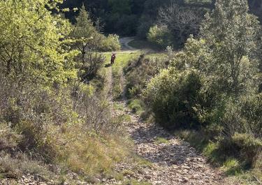
The Col d'Anès, also known as the Donkey Pass, is accessed by a narrow, unpaved track that connects Saint-Étienne-en-Quint with Ponet-et-Saint-Auban. This route, located in the southern Vercors, offers a gravel alternative to the northeast-facing Col de Marignac.
Despite some longitudinal and cross-ruts, the track is generally passable. The average gradient is about 8%, with some short sections featuring steeper ascents. The northwest ramp presents a greater challenge, as it is steeper and the surface is more eroded. Additionally, there are two tight, steep hairpin turns.
The path offers only sporadic views of the surrounding hilly landscape and winds mostly through a low mixed forest.
At the summit, there is a prohibition sign that excludes large multi-axle vehicles such as motorhomes, vans, and trucks from using the northwest ramp.
Conditions, closures and tips — from members who drove here recently.
Access is not legally permitted, as the road is closed in both directions, even to 4x4 vehicles. See photo.
Thank you

 France