German

Col de la Met
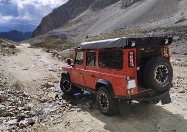
The Col de la Met is located in the Auvergne-Rhône-Alpes region. Situated high above the Lac du Mont Cenis, the Col de la Met offers a wonderful panoramic view of the reservoir and the surrounding mountains. This pass can only be reached from one side via a rough and extremely steep gravel road. The difficulty level is 4-5 and the tour is not recommended in the rain.
The off-road tour starts on the left at the D1006 Lanslebourg - Mont-Cenis. Passing chairlifts, the route climbs steadily uphill with gradients of up to 20%. Later on, the route becomes more winding and more challenging due to loose slate rock. Shortly before reaching the Col de la Met, the route goes through 7 narrow hairpin bends, always along the edge of the precipice.
Latest reports
Conditions, closures and tips — from members who drove here recently.
 Italy