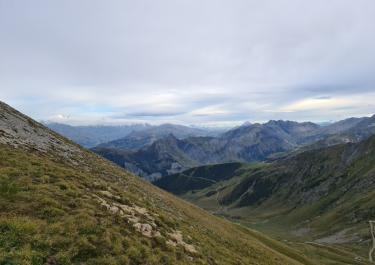
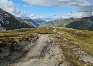
The Col de la Madeleine stands at 1,993 meters and connects the two valleys of Maurienne and Tarantaise. Thanks to the winding road that ascends toward it, the D 213, it is considered a treat by motorcyclists. However, an alternative route is much more thrilling: the D 77, which starts as an asphalt road out of the Tarantaise valley and becomes a gravel path for the last eleven kilometers leading to the Madeleine.
The starting point is in the Tarantaise valley in Pontamafrey. The road winds up the mountainside for 20 kilometers, first transitioning from rough asphalt to fine gravel. On a wide, easy-to-ride track, the journey continues upward into the treeless zone, offering stunning views. Solitary mountain huts and peacefully grazing cows on expansive alpine meadows are seen along the way. Several ski lifts cross the path, and down to the left, the houses of the ski resort Saint-François-Longchamp are visible. Passing by a cheese dairy, the track gently descends and reaches the D 213 after about a kilometer. A right turn here leads to the Col de la Madeleine.


 German

 France