

 German

Fort la Redoute
Near the Italian border, the 55 km tour starts at Breil sur Roya on the D2204. It takes you through impressive gorges and to historic forts in the French Alps.
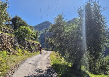
First, take the D6204, which runs parallel to the River Roya, onto the D2204 and from here up towards La Maglia. On a very narrow tarred road along striking rock faces, you cross the La Maglia gorge. The next section is on gravel through the forest, over clearings and past beautiful picnic spots. There are fantastic views of the beautiful mountain landscape along the mountainside. At the height of the Baisse de Colla Bassa, the views extend as far as the sea on a clear day. Ruins of military accommodation can be found on the wide meadows through which the track winds. You reach the picturesque Fort La Redoute. It is situated on a hill, an enchanting place with fabulous panoramic views of the mountains and other ruins in the surrounding area. After this detour, the last part of the track leads through the forest and richly downhill into the valley to the D 40. This small tarred road leads down again through a rocky gorge, past individual houses, until the tour ends at the D 6204. Afterwards, it is worth taking a trip to the nearby mountain village of Saorge with its small alleyways and an interesting monastery surrounded by beautiful gardens.
Latest reports
Conditions, closures and tips — from members who drove here recently.
 France




