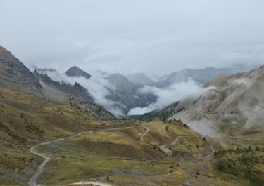
This 18 km tour takes you uphill into the beautiful alpine landscape of the Parc National de Queyras, passing the Col Lauzet and the lake of the same name. The upper section is a bit rougher but still well passable.
The route begins at Saint Crepin on N94. Initially, follow the winding D 738 road, then head straight uphill to Le Villard. Here, the road turns into a gravel track marked Lac de Lauzet. The path winds through numerous bends, partially through the forest, and passes a small group of houses with a fountain. From the clearings, enjoy views of the massive peaks. The green mountain lake Lac de Lauzet, surrounded by rocks and pine trees, is directly along the path. You’ll be rewarded with a great spot to relax and take in the fantastic mountain panorama. Shortly after, there is a rockier section before reaching the Col du Lauzet. At the top, a barrier marks the end of the route. The pass offers numerous hiking trails for exploring the national park.


 German


 France