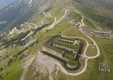
The tour starts with the ascent to the Col de Tende, which enjoys cult status. This is mainly due to the breathtaking sight of 48 tightly stacked hairpin bends, of which unfortunately only the upper third is gravel.
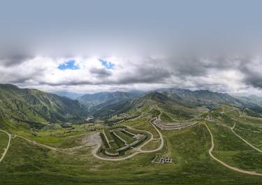
The majestic Fort Central towers high above. It is located at an altitude of 1,870 meters and offers an impressive view. The fort was built in the 19th century and was once used to defend the border between France and Italy.
Over the Col de Tende and past a bunker, the track to Fort de la Marquerie turns off to the left. It runs along the slope through open terrain with beautiful views of the hairpin bends. The remains of Fort Pernante can be seen on the right.
The Fort de la Marquerie was built in the 19th century. Today, you can still visit the barracks, gun emplacements and defenses. There are also exhibitions on the history of the fort and guided tours to learn more about its significance.
Continue along the old military road on a partly gravel surface up to the Baisse de Peyrefique. On the way there, you pass the house of "Asile Arnaldi" before reaching the plateau at 2040 m. From here, you have a fantastic panoramic view of the surrounding mountain slopes with further bunkers.
From the Baisse de Peyrefique, head towards Casterino and after about 200 m (GPS 44.113251, 7.522570) take a sharp right turn for a challenging extra loop. The route leads around the Vallon de Casterino, mainly on gravel with a few tarred sections. First you ride through open terrain before the forest road leads uphill, sometimes with a gradient of 15%, through a wooded area. After a short passage along the slope, the route heads south along the other side of the Vallon de Casterino. Through another wooded area you reach the road to Casterino. Shortly before the signpost to Casterino (GPS 44.112908, 7.496534), take a sharp right onto the next gravel path. The route continues along the Mercantour National Park, mainly on a rough stone path around the Vallon de Fontanalba. After crossing the small river of the same name, the route continues on the other side of the valley to Casterino on the D 91, where you can take a break at the Auberge Val Casterino, for example.
Leave the D 91 on the left at the Hotel Chamois in the direction of the Baisse de Peyrefique. The route leads mainly through a wooded area with a few hairpin bends with gradients of up to 16%. Below the plateau (GPS 44.113144, 7.522546) turn right towards the Baisse d`Ourne. The pass at an altitude of 2040 m offers a magnificent mountain panorama.
The Mont Agnelet (2201 m) is a great little detour here. The impressive mountain peak offers a magnificent view as well as insights into a bygone era. The remains of the bunkers from the Second World War are a special attraction for history buffs and adventurers.
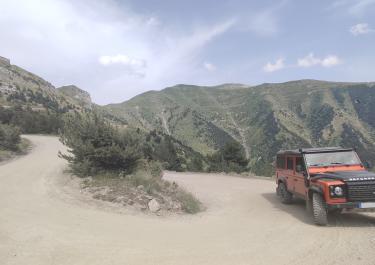
The narrow, in places very roughly gravelled and uneven cul-de-sac branches off from the Baisse d'Ourne in a south-westerly direction. After about one kilometer, you reach the "split rock", two individual rocks on either side of the road. If you turn sharply to the left before this point, after about 1.5 kilometers and three very tight hairpin bends (with a maximum gradient of 18%) on rough ground, you will reach a turning point below the summit (2159 m). A second path also turns left behind the rock gate, has a maximum gradient of around 12% and ends after around 2.5 kilometers and several tight hairpin bends, also just below the summit.
Back at the Baisse d`Ourne, turn right onto the road down to Tende to the D 2604. This leads over 37 hairpin bends mainly through a wooded area.
Degree of difficulty according to Denzel 2-3
Editor's note: The pass on the French side has been blocked by a rockslide for some time and is therefore impassable. At the time of going to press, it was not yet clear whether and when this situation will change. However, it is still accessible from the Italian side. The tunnel is also open in both directions.


 German

 France


 Italy