!!! Attention, closure !!! According to a message from the community, the route is closed (as of July 2024).
On this 31 km tour, starting at Fontan north of Saorge on the D 6240, you will experience stunning mountain landscapes with waterfalls and diverse vegetation.
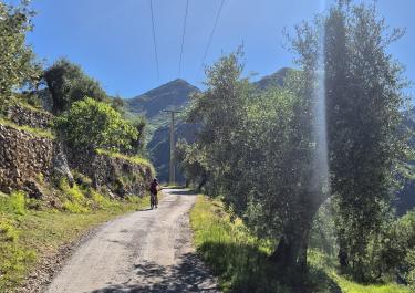
The route begins on a very narrow paved road, winding adventurously uphill through rocky hillscapes with numerous tight curves. At Berghe Inférieur, the gravel track begins, continuing uphill through forests and past scattered houses. The magnificent alpine scenery below the peaks is breathtaking. Further along, the treeless slopes provide stunning views into the valley.
The final section descends over a dusty stretch of a wide gravel road, with numerous sharp hairpin bends, eventually leading to the D 40. This narrow, single-lane paved road winds through a gorge along the river, taking you near the picturesque mountain village of Saorge. Along the wild Roya River, there are many popular swimming spots surrounded by rocks, offering crystal-clear waters in pristine nature.


 German


 France